
Pokemon players create AI world map
Earth's most detailed public 3D database

Pokémon players are creating the world's most detailed 3D map. This AI-powered database can "complete" objects from partial scans, similar to how ChatGPT completes sentences.
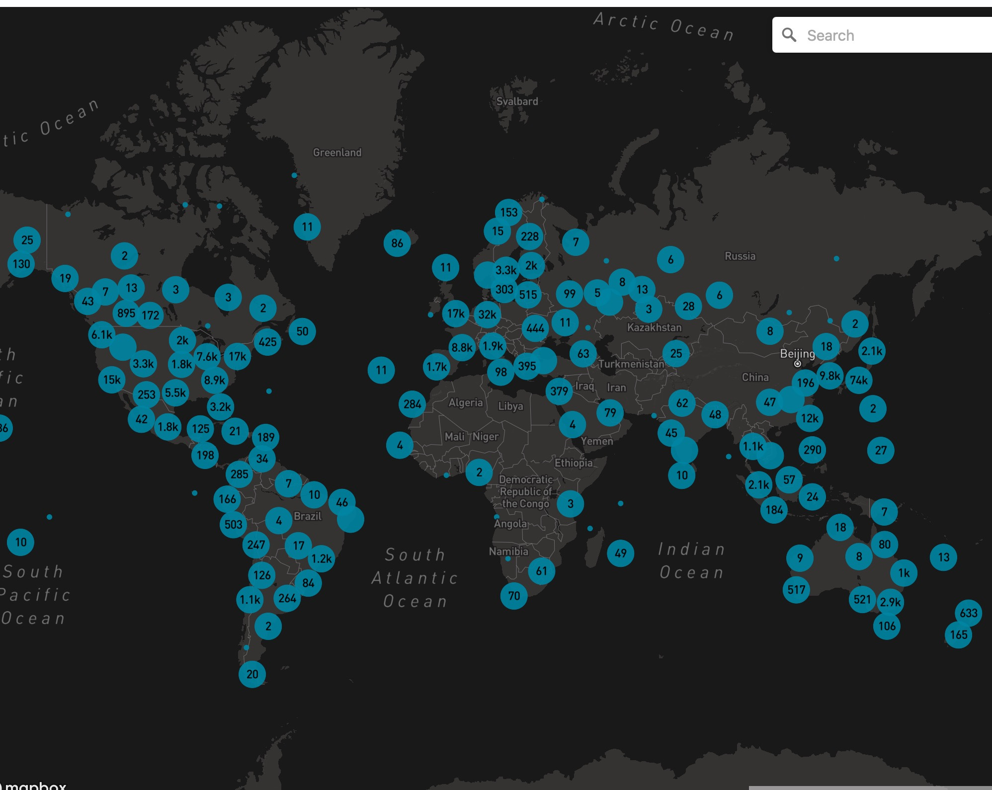
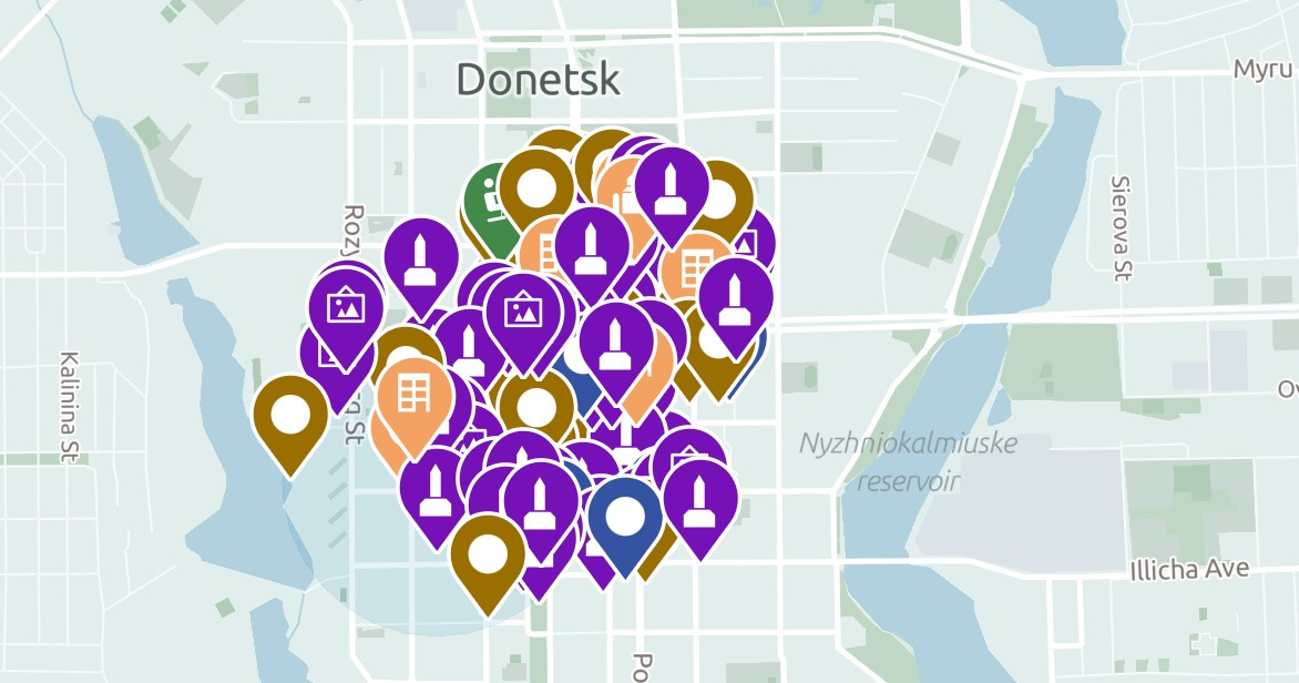
The inventory grows with over 1 million scans per week, capturing a wealth of geospatial data on objects, buildings, art, outdoor scenery, and public transportation. This data is publicly accessible (see below).
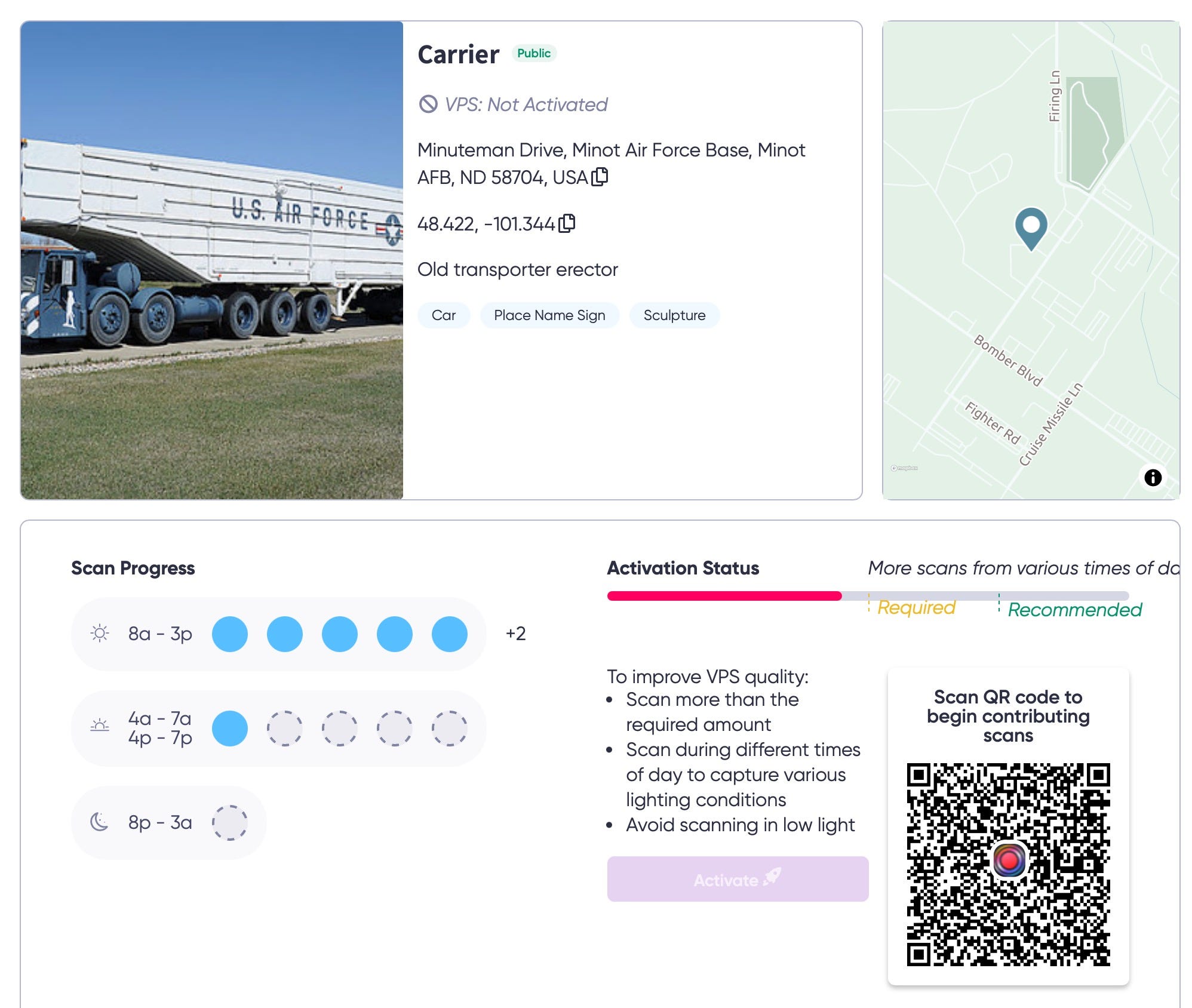
The company behind this, Niantic, is asking Pokémon trainers with level 20 or higher to voluntarily film PokéStops, complete with timestamps, GPS coordinates, and their phone's entire dance routine while recording. With that and other data, Niantic builds an ultra-precise 3D map that can be valuable for open source investigators, in addition to serving AR games and other commercial purposes.

If shown half a church, the model can infer the likely appearance of the other half based on its extensive knowledge of church designs. The system uses both classical 3D reconstruction and advanced neural network-based mapping techniques.
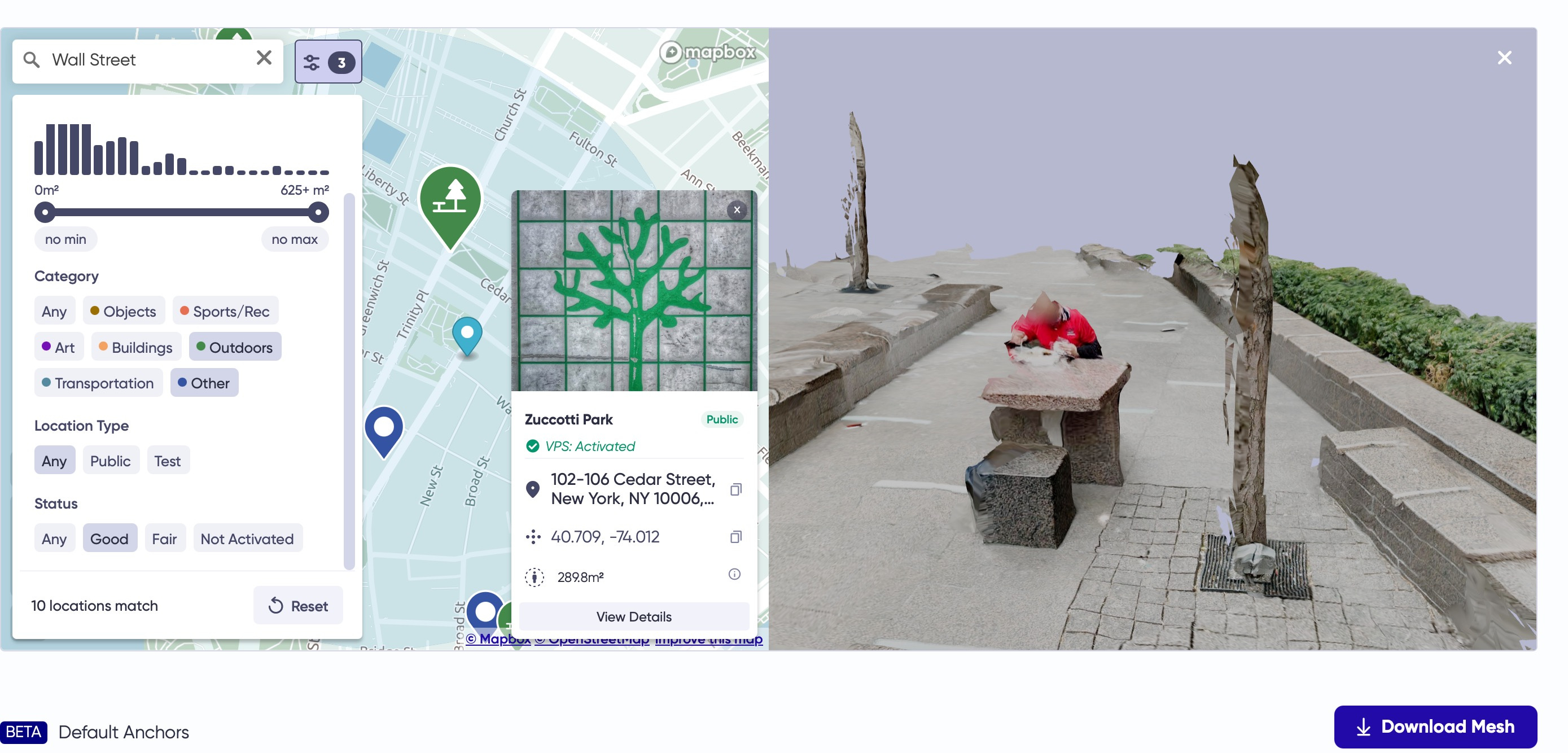
Niantic is trying to build something that will essentially give computers a human-like understanding of space, they claim. They've trained neural networks that can play "guess what's behind that building". Their new Large Geospatial Model doesn't just see what's in front of it - it can predict what's around the corner based on seeing thousands of similar places. Niantic spun off from Google in 2015 and created Pokémon GO, developed a Visual Positioning System (VPS). That system builds on their earlier AR work with Google Maps and Ingress.
From "digital maps" to "omniscient spatial awareness systems” is still a big step, but I was amazed to see how many details are captured in my own street or that of others. Even so now and then a military object seems to pop up, but these are mostly place holders for “soon to be scanned” Pokestops or museum pieces.

Below is a video how neural mapping works when a Pokemon player is on the move:
With over 10 million scanned locations, this system represents an unprecedented level of detailed global spatial data collection:
How to acces and use the database:
